3D Mapping Services from HTS has the equipment, people, knowledge, and contacts to fully tailor a solution for all of your aerial and vehicle mapping and photogrammetry projects. With more than 20 years of experience and a global support team available 24 hours a day, 7 days a week, we are just a phone call away.
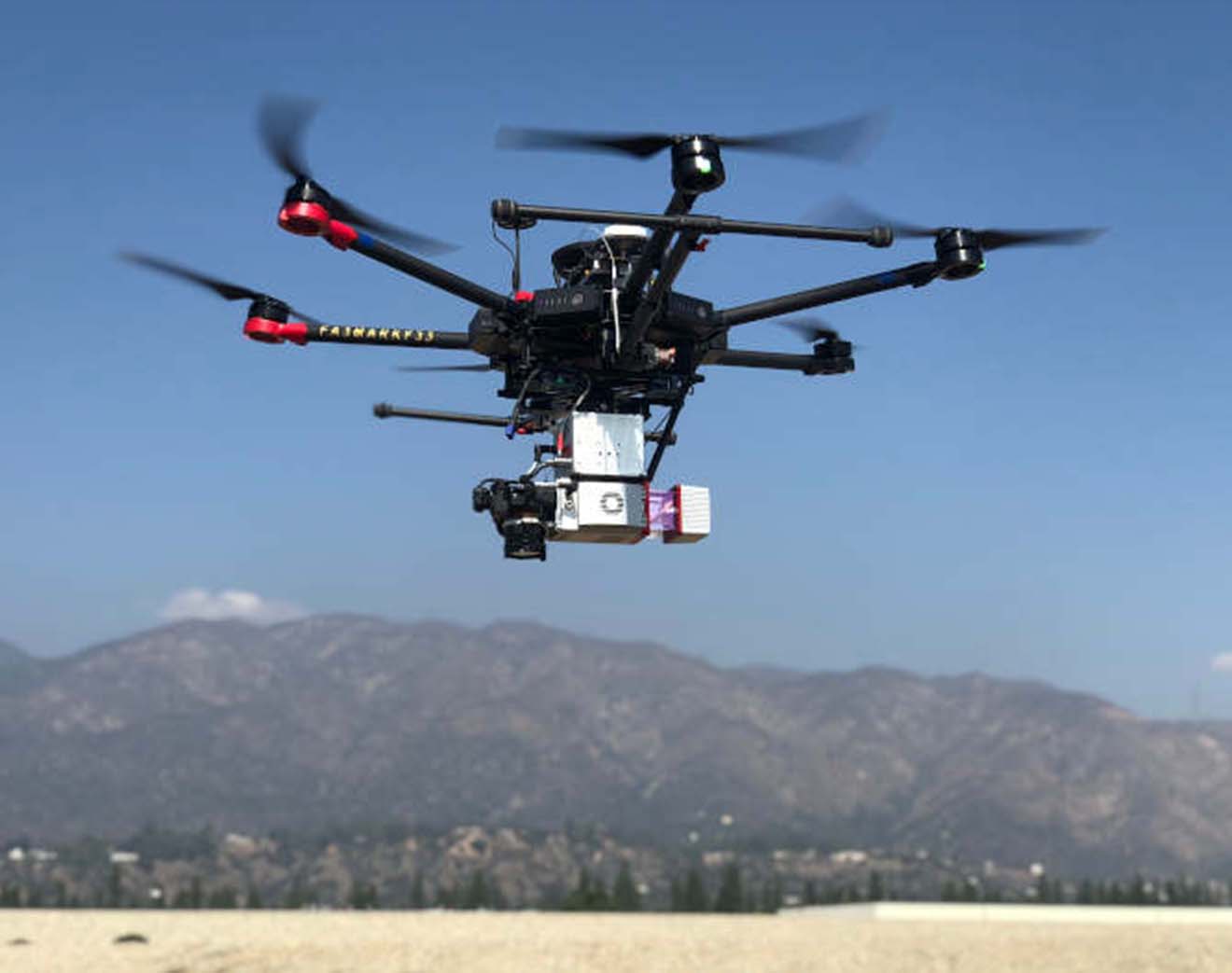
If you don’t have the equipment or are not sure about using it efficiently to obtain the most accurate results let us carry it out for you. HTS can provide licensed drone (sUAS ) pilots along with equipment including Matrice 600 Pro sUAS, LiDAR USA’s Snoopy A-Series, Zenmuse Cameras, and AeroPoints GCPs.
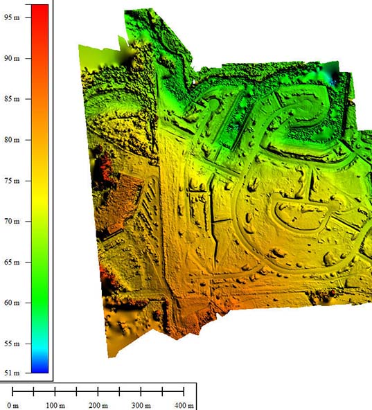
With data collected via aerial and/or vehicle mapping, we can create orthomosaic maps; digital elevation, surface and terrain models; and 3D Point Cloud.
Many photos are combined together to create this type of detailed, accurate, true-to-scale, orthorectified area map. This aerial photography gives a true surface depiction of distance since topographic relief, lens distortion and camera tilt have all been adjusted.
Similar to a DEM, LiDAR is used to create a Digital surface model (DSM); however, a DSM includes man-made and natural features while a DEM does not.
Produced by 3D scanners, a 3D point cloud provides high-resolution data, measuring a large series of data points in a given space.
The digital elevation model (DEM) represents surface relief through measurement between points of elevation. Images are captured through photogrammetry and LiDAR and AeroPoints Ground Control Points (GCP’s) are used to filter out man-made and natural non-ground points that aren’t depicted in this bare-earth type of elevation model.
Digital terrain models (DTM) are created through photogrammetry and shows specific terrain features very clearly.
HTS Mapping can help you measure terrain to design or monitor construction site progress, create drainage systems, conduct power line maintenance and inspections, inspect solar farms and telecommunication towers, reconstruct accident sites, monitor pipelines, and manage assets as well as many more projects in a variety of industries.
Some applications HTS Advanced Solutions 3D Mapping Services can assist includes
Experience a bird’s eye view with our Matrice 600 Pro drones, aerial LiDAR and cameras. Obtain images over a large area of terrain from high altitudes with our equipment available to rent or serviced by our licensed sUAS pilots.
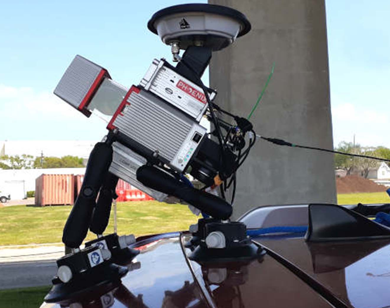
Scan terrain from the ground with our vehicle mapping equipment. Our Phoenix LiDAR MiniRanger unit can be mounted to your car or truck. Apart from this, It’s easy-to-operate; all you need to do is drive and you’ll safely obtain more data at a faster rate than with traditional survey work.
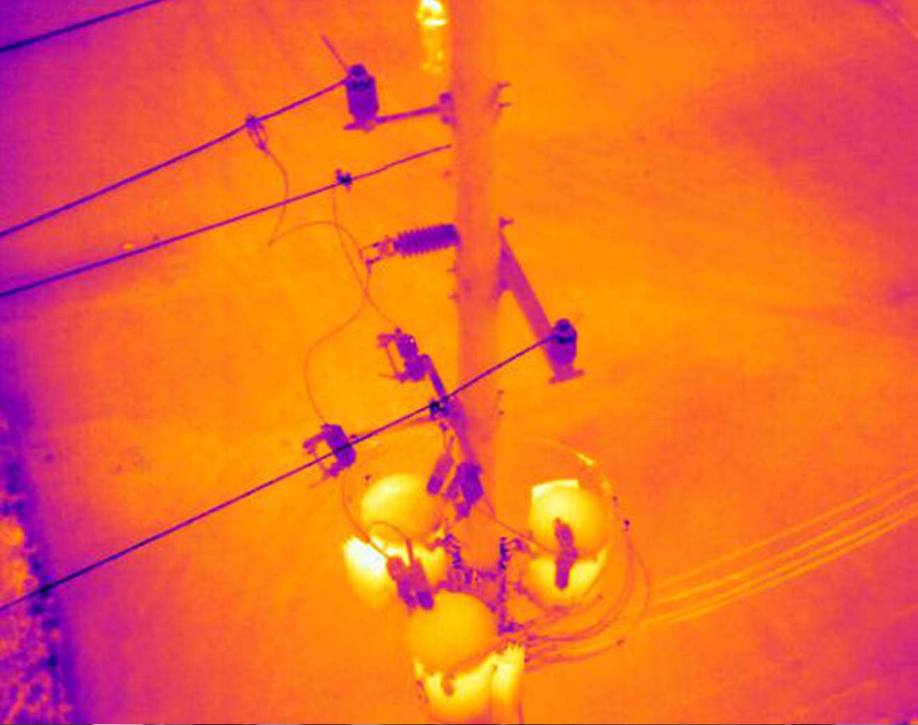
HTS 3D Mapping services conducts aerial thermal inspections using drones (sUAS) to inspect inaccessible areas that are otherwise difficult to reach because of low-visibility or high-risk situations, such as roofs, solar panels, and utility equipment. In addition, HTS assists with search and recovery missions for both animals and people.
HTS Mapping can determine the precise location of a roofing problem so instead of replacing the whole roof, you can isolate the damaged area for repair. Also, we can identify issues with insulation and siding as well as mechanical or structural design. Clearly, potential problems are best pinpointed before they become major repairs, increasing the overall safety and energy efficiency of your building.
Thermal imaging can identify possible problem spots with utility equipment before it breaks down.
HTS Mapping performs accurate, detailed inspections using aerial thermal imaging to evaluate solar farms: defective cells & panels are identified to help you maintain peak efficiency. A thermal imaging camera mounted on a drone (sUAS) is a safe & cost-effective way to inspect and troubleshoot solar farms without the need to power down your system and deploy an inspection team.
When looking for missing pets or people HTS Mapping can cover more ground than a vehicle or search on foot with a thermal camera attached to a drone (sUAS). Undoubtedly, this is important to saving lives when time is of the essence.
Contact us to learn more about our 3D Metrology Services, you can reach us at info@hts-3d.com or call us at (833) 273 6833